GRMW Subbasin Gauging Station Operation 2022 & 2023
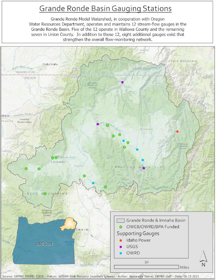
The Grande Ronde Basin (GRB) covers over 5,000 square miles and includes several thousand miles of perennial flowing streams, many being the home to ESA listed Snake River spring/summer Chinook salmon, Snake River summer steelhead and bull trout. A network of stream gauges are in place throughout the Grande Ronde and Imnaha River subbasins to inform and provide data for irrigation water management, fisheries management, long term flow and trend analysis, TMDL and SB1010 water quality management plan effectiveness, subbasin plan implementation, restoration project development and provide essential information regarding cumulative effects response to conservation in the Grande Ronde Basin. This project is in place to operate 12 existing stream gauges in combination with US Geological Survey (USGS) (3 gauges, East Fork Wallowa River, Minam River and Grande Ronde River at Troy), Idaho Power (1 gauge, Imnaha River at Imnaha) and Oregon Water Resources Department (OWRD) who, independent of this project, operate five additional gauges (Lostine River at Caudle Lane, Wallowa River above Wallowa Lake, Wallowa River at Enterprise, Wallowa Lake, Catherine Cr. near Union) to characterize flow in both the Grande Ronde and Imnaha subbasins. Stream flow characteristics including headwater contribution, land management influence, and basin outlet data are all selectively collected in this network of 21 flow gauges. Production partners include Grande Ronde Model Watershed (GRMW) and Oregon Water Resources Department (OWRD) with funding partners being BPA, OWEB and OWRD.
Gallery