Limber Jim Creek Restoration Project

GRMW ID: 1947

Fiscal Year: 2017

Project Status:

Complete

Description

Limber Jim Creek Restoration Project

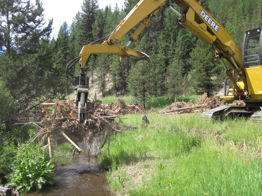
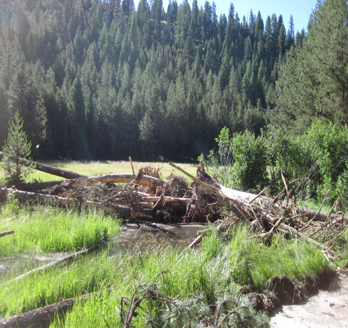
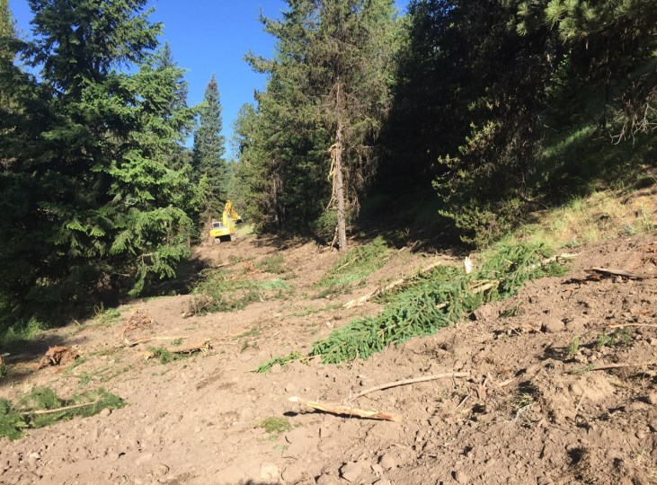
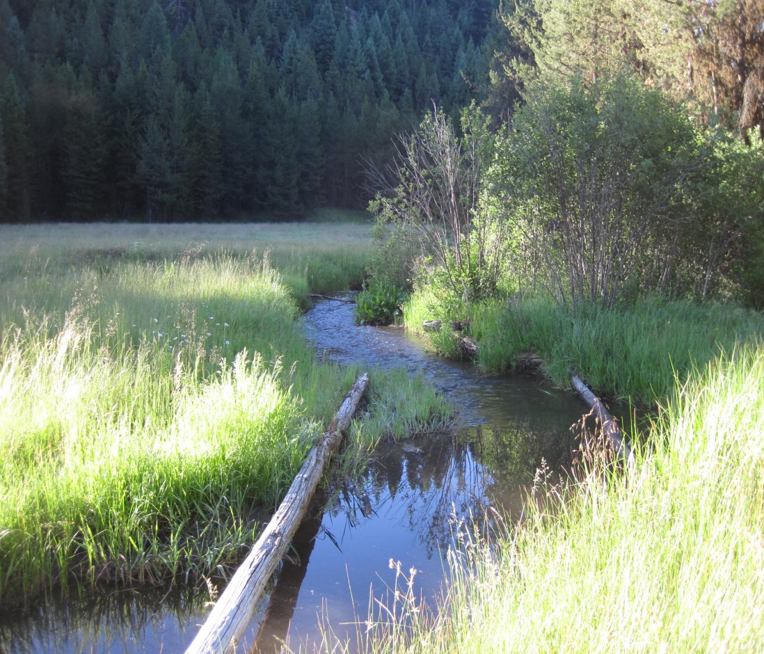
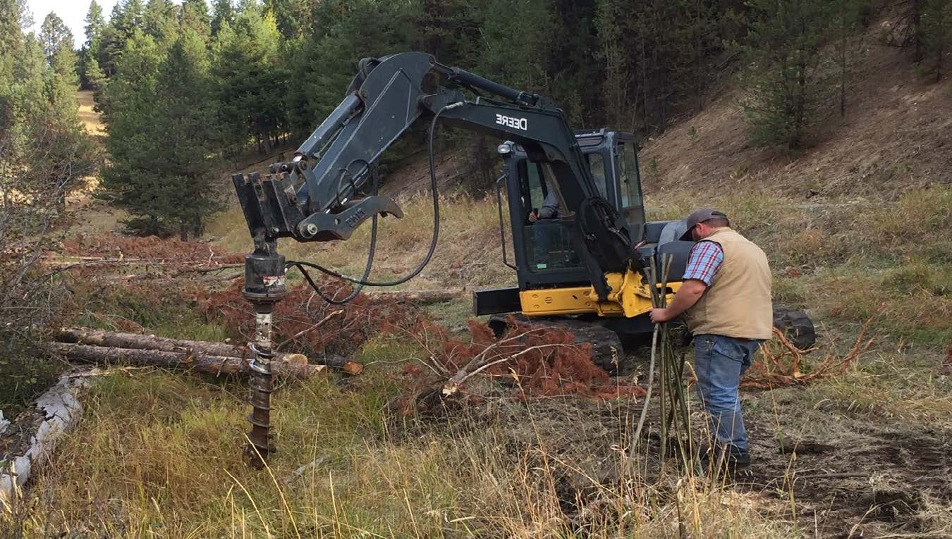
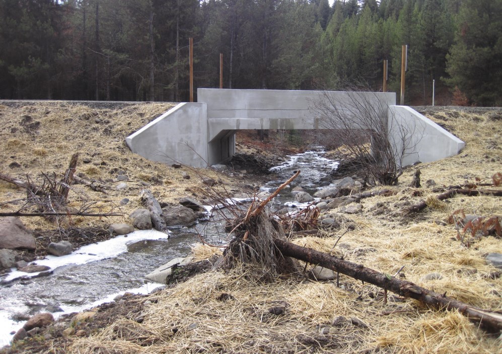
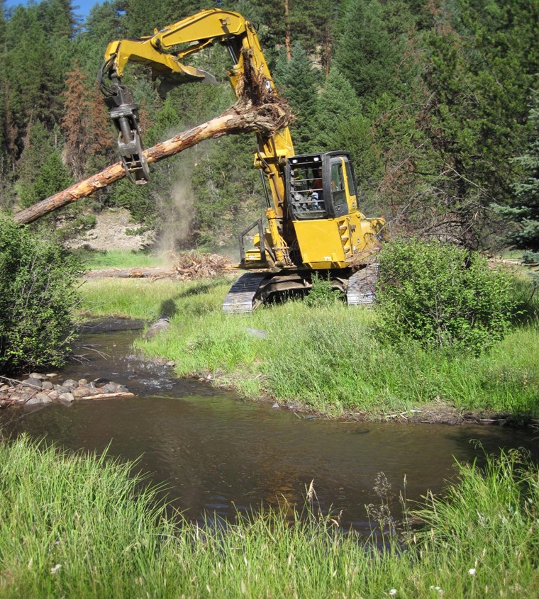
The Limber Jim Creek Restoration Project is located on Limber Jim and South Fork Limber Jim Creek, tributaries to the Grande Ronde River. The project is located on approximately 3.1 miles of Limber Jim Creek (approximately RM .5 – 3.6), and within the first river mile of South Fork Limber Jim Creek. Limber Jim Creek is spawning and rearing habitat for Snake River Basin Chinook salmon, summer steelhead, bull trout and redband trout. Historic timber harvest and grazing, roading and mining reduced the future recruitment of large wood and the amount/types of riparian vegetation. These combined impacts also changed pool/riffle ratios, residual pool depth, habitat complexity, and floodplain function. The stream within the project area, no longer has livestock grazing within the project area. There are existing mining claims with little activity and dispersed recreation camping areas. Three culverts on South Fork, North Fork and mainstem Limber Jim Creeks do not adequately pass fish at all life stages (two of these culverts will be replaced under a different project and one will removed to meet fish passage needs). Sill logs were placed in the late 1980s/early 1990s to improve pool habitat. There are three big game exclosures on mainstem Limber Jim Creek that are partially down. Closed stream bottom roads exist on mainstem Limber Jim and tributaries. Riparian vegetation primarily consists of sedges, rushes, lodgepole pine and alder.

Project Site Locations

Development Sites

Site name Latitude/Longitude Download
General Project Location 45.0997070753582/-118.33123178405161 Download KML

Contacts & Roles

Name Role Organization
Joe Platz Contract Manager La Grande Ranger District
Aric Johnson Supervisor La Grande Ranger District

Organizations

Organization Role
Bonneville Power Administration Funding Entity
United States Forest Service Sponsor

Grants & Contracts

Organization Contract # Funding Amount
Bonneville Power Administration 75265 $276984.00
United States Forest Service N/A $9615.00
United States Forest Service In Kind $25985.00

Documents

Document Type View Download
Completion Report View Document Download Document
Project Proposal N/A Download Document
Vicinity Map View Document Download Document

Metrics

Metric ID Units Work Elements Metric
1387 3.10 29. Increase Aquatic and/or Floodplain Complexity # of miles of stream with improved complexity
1401 0.50 40. Install Fence # of miles of fence installed in a riparian area
1406 3.10 47. Plant Vegetation, 53. Remove Vegetation, 197. Maintain/Remove Vegetation, 198. Maintain Vegetation, 199. Remove Vegetation # of riparian miles treated
1441 1.00 52. Remove Mine Tailings, 84. Remove/Install Diversion, 85. Remove/Breach Fish Passage Barrier, 180. Enhance Floodplain/Remove, Modify, Breach Dike, 184. Install Fish Passage Structure # of miles of habitat accessed to the next upstream barrier(s) or likely limit of habitable range
1517 29.00 47. Plant Vegetation, 48. Practice No-till and Conservation Tillage Systems, 53. Remove Vegetation, 180. Enhance Floodplain/Remove, Modify, Breach Dike, 197. Maintain/Remove Vegetation, 198. Maintain Vegetation, 199. Remove Vegetation, 30. Realign, Connect, and/or Create Channel, 31. Conduct Controlled Burn, 52. Remove Mine Tailings, 55. Erosion and Sedimentation Control # of acres of riparian non-wetland habitat treated
1517 24.00 47. Plant Vegetation, 48. Practice No-till and Conservation Tillage Systems, 53. Remove Vegetation, 180. Enhance Floodplain/Remove, Modify, Breach Dike, 197. Maintain/Remove Vegetation, 198. Maintain Vegetation, 199. Remove Vegetation, 30. Realign, Connect, and/or Create Channel, 31. Conduct Controlled Burn, 52. Remove Mine Tailings, 55. Erosion and Sedimentation Control # of acres of riparian non-wetland habitat treated
1549 0.20 40. Install Fence # of miles of left streambank fenced in a freshwater area
1551 0.20 40. Install Fence # of miles of right streambank fenced in a freshwater area
1584 42.00 29. Increase Aquatic and/or Floodplain Complexity # of logjam structures installed for only complexity
1606 0.25 33. Decommission Road/Relocate Road # of miles of road or trail blocked in the riparian zone
1608 0.30 33. Decommission Road/Relocate Road # of miles of road or trail recontoured in the riparian zone
1608 0.52 33. Decommission Road/Relocate Road # of miles of road or trail recontoured in the riparian zone
1748 74.00 29. Increase Aquatic and/or Floodplain Complexity # of pools created for only complexity
1760 3.00 40. Install Fence # of acres of riparian non-wetland habitat protected by fencing
1626 3.00 40. Install Fence # of other exclusion structures